Motivation & Value proposition
Soil erosion caused by water is a widespread and costly issue, affecting agricultural productivity, damaging infrastructure, and degrading crucial ecosystem services. For instance, in Southern Italy, one of Europe’s most erosion-prone regions, land planning and infrastructure development are increasingly exposed to the risks posed by soil loss. On the other hand, no services providing timely, high spatiotemporal resolution assessments of this phenomenon do exist.
The growing need for actionable, high-resolution erosion monitoring tools has created a demand for services that can guide decision-making and climate-resilient investment strategies. Use Case 5 (UC5), led by the CMCC, addresses this need by delivering a service for assessing soil erosion at sub-annual resolution and considering different climate and infrastructure scenarios. It combines Earth Observation (EO) data, artificial intelligence (AI), and the EO4EU platform's advanced capabilities to produce detailed, up-to-date information on erosion potential.
The service targets stakeholders involved in land management, agriculture, and infrastructure design, offering
them reliable tools to assess and mitigate erosion-related impacts and identify the hotspots where this phenomenon is more severe, thus allowing for targeting and customizing management practices. By enabling scenario-based analysis and high-frequency monitoring, UC5 adds value across sectors, aligning with EU sustainability goals.
Strategic Applications
The UC5 soil erosion assessment service offers strong potential for exploitation in several sectors:
- Transport: Informing the design and maintenance of roads, railways, and other transport systems in erosion-prone areas to reduce long-term costs.
- Agriculture: Identifying areas and periods of the year at risk of productivity loss due to soil erosion and guiding soil conservation practices.
- Insurance: Supporting insurers in assessing land degradation risks and setting premiums or coverage models based on location-specific potential erosion severity.
- Environment: Providing information for land degradation neutrality reporting and compliance with EU soil protection directives.
- Public/Regional authorities: Enhancing land use planning, policy implementation, and climate adaptation strategies.
Scalability & Exploitation potential
UC5 has been designed for scalability. By using standardized, modular processing chains and interoperable Earth Observation datasets, the soil erosion assessment service can be expanded to other Italian and European regions and adapted for global deployment. The approach supports dynamic input scenarios, including future climate projections, enabling consistent erosion assessments anywhere with appropriate input data.
The service is accessible via the EO4EU platform, allowing users to run custom workflows for specific areas, timeframes, and scenarios (as detailed in the user’s guide). Users can use the service for integration into national and regional environmental frameworks to assess progress towards sustainable land and resource management, land degradation neutrality, and soil health, among others.
Current Status
A prototype version of the service is currently running on the EO4EU platform, while a more robust version will be deployed soon.
Example: land cover and management (RUSLE C-factor) computation
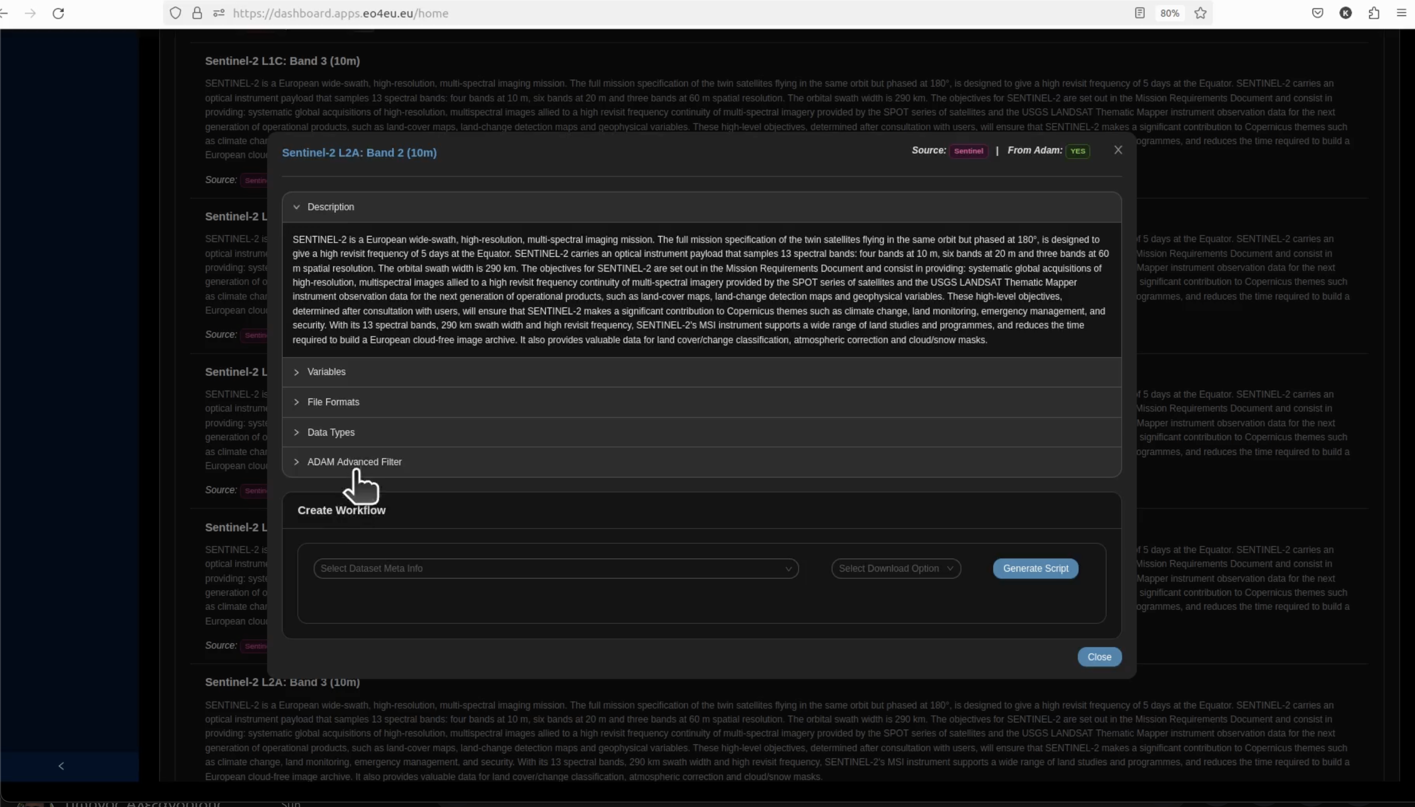
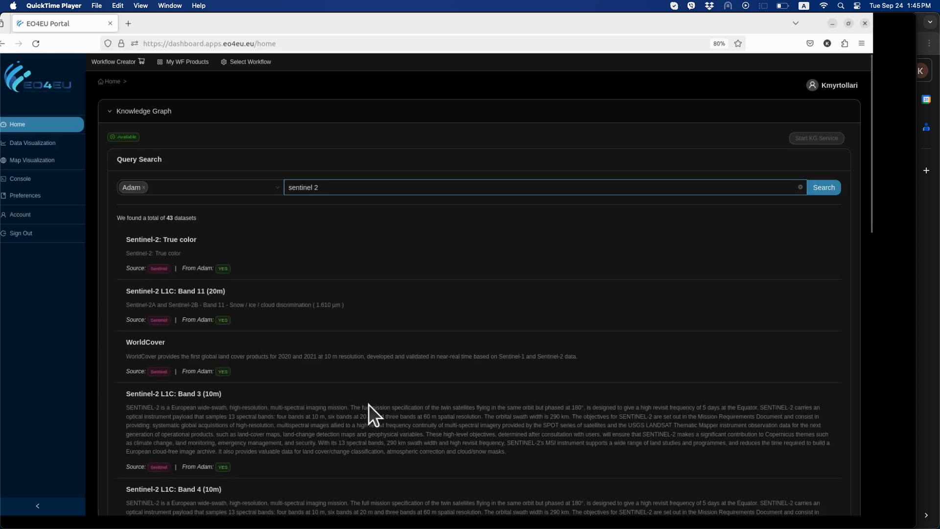
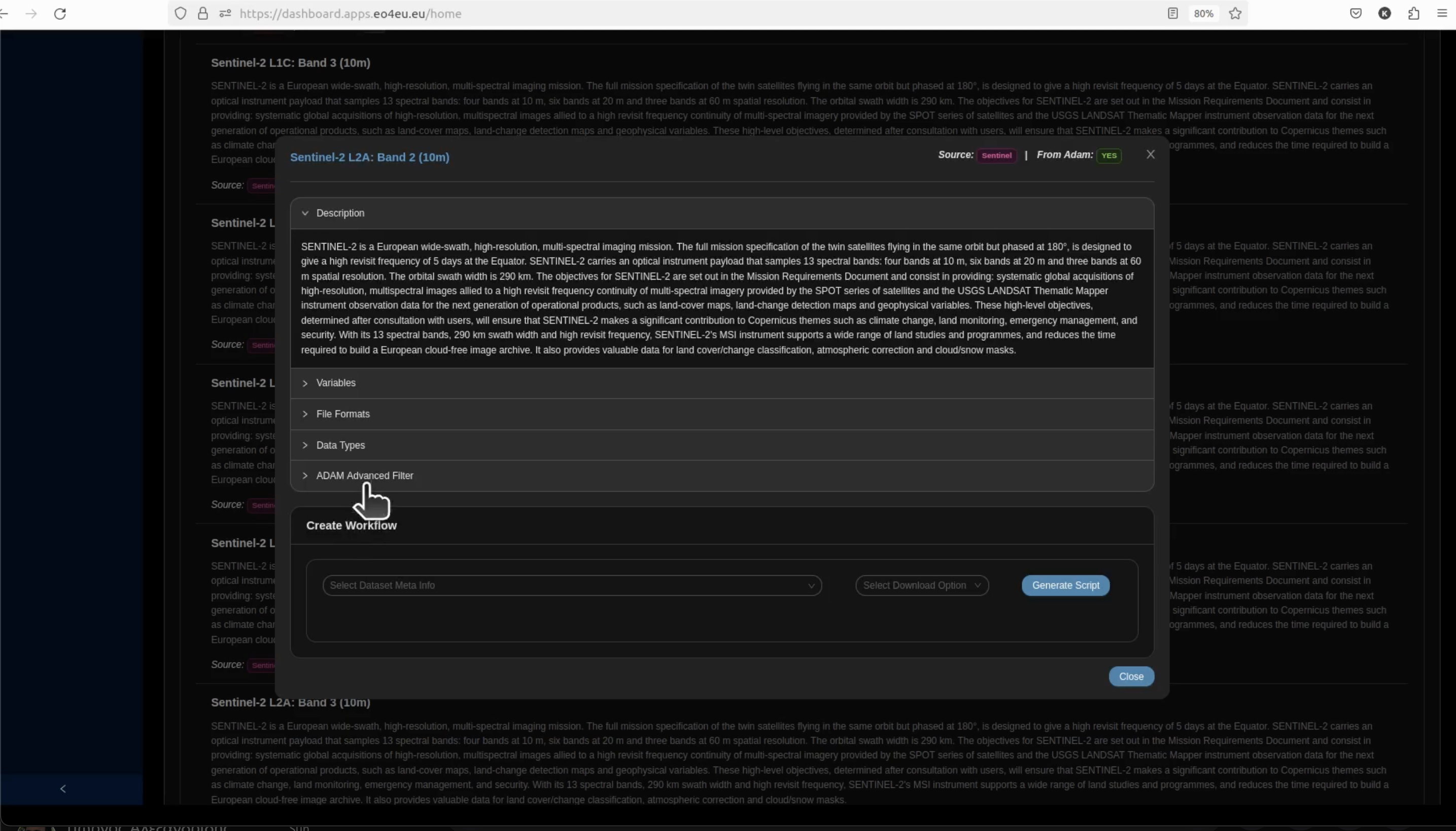
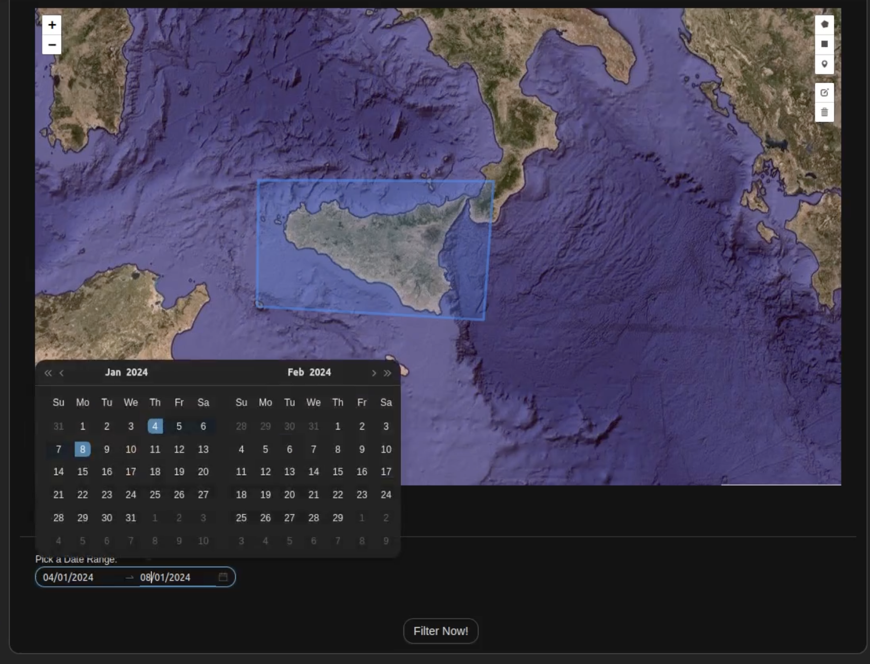
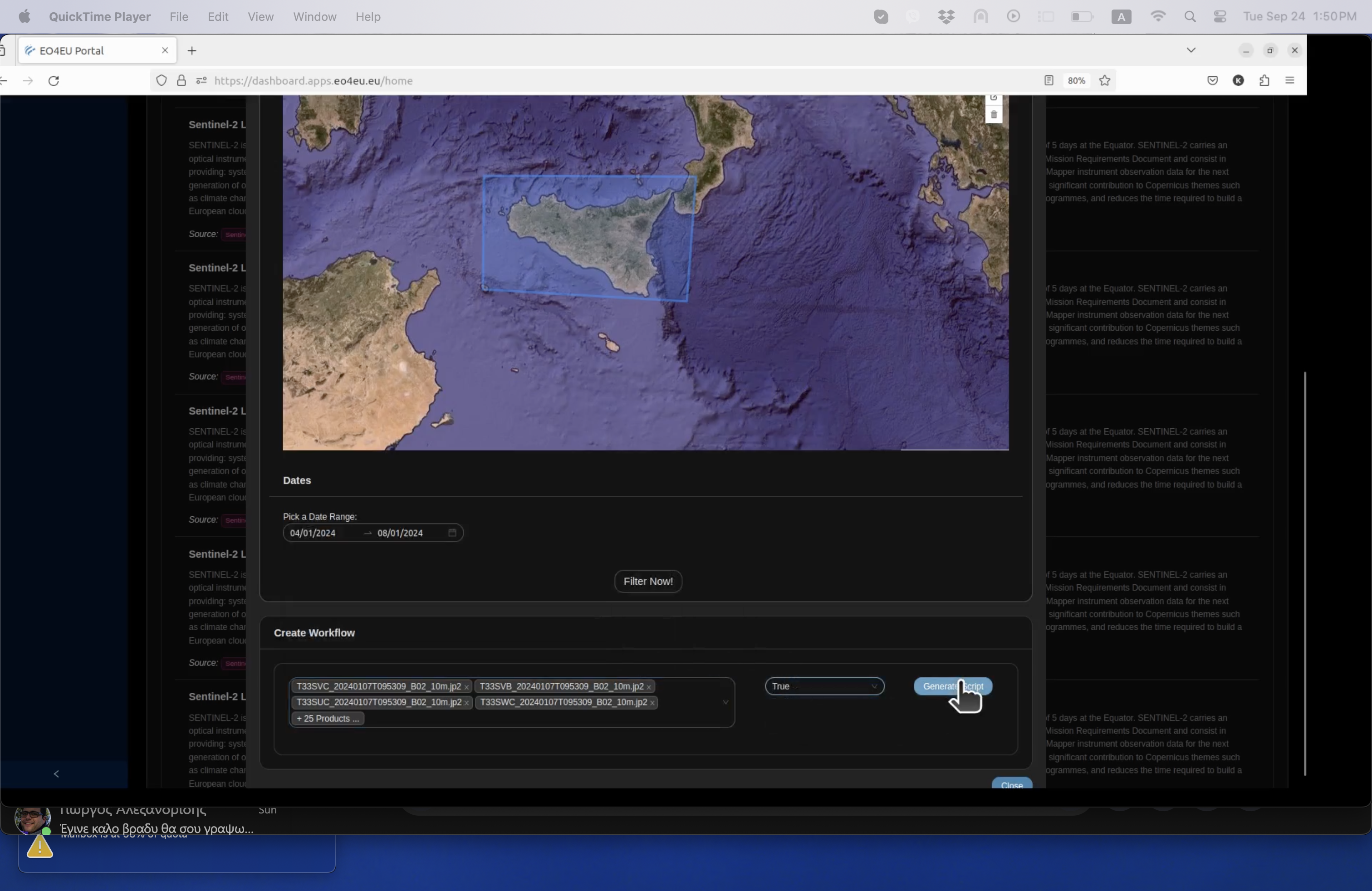
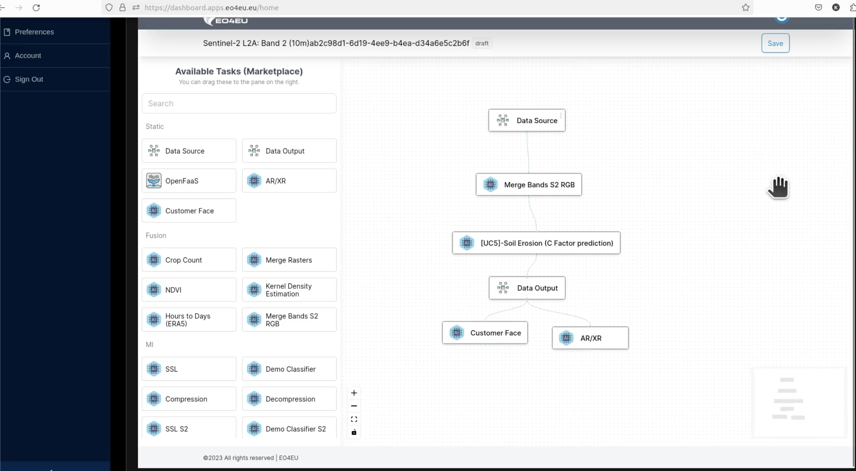
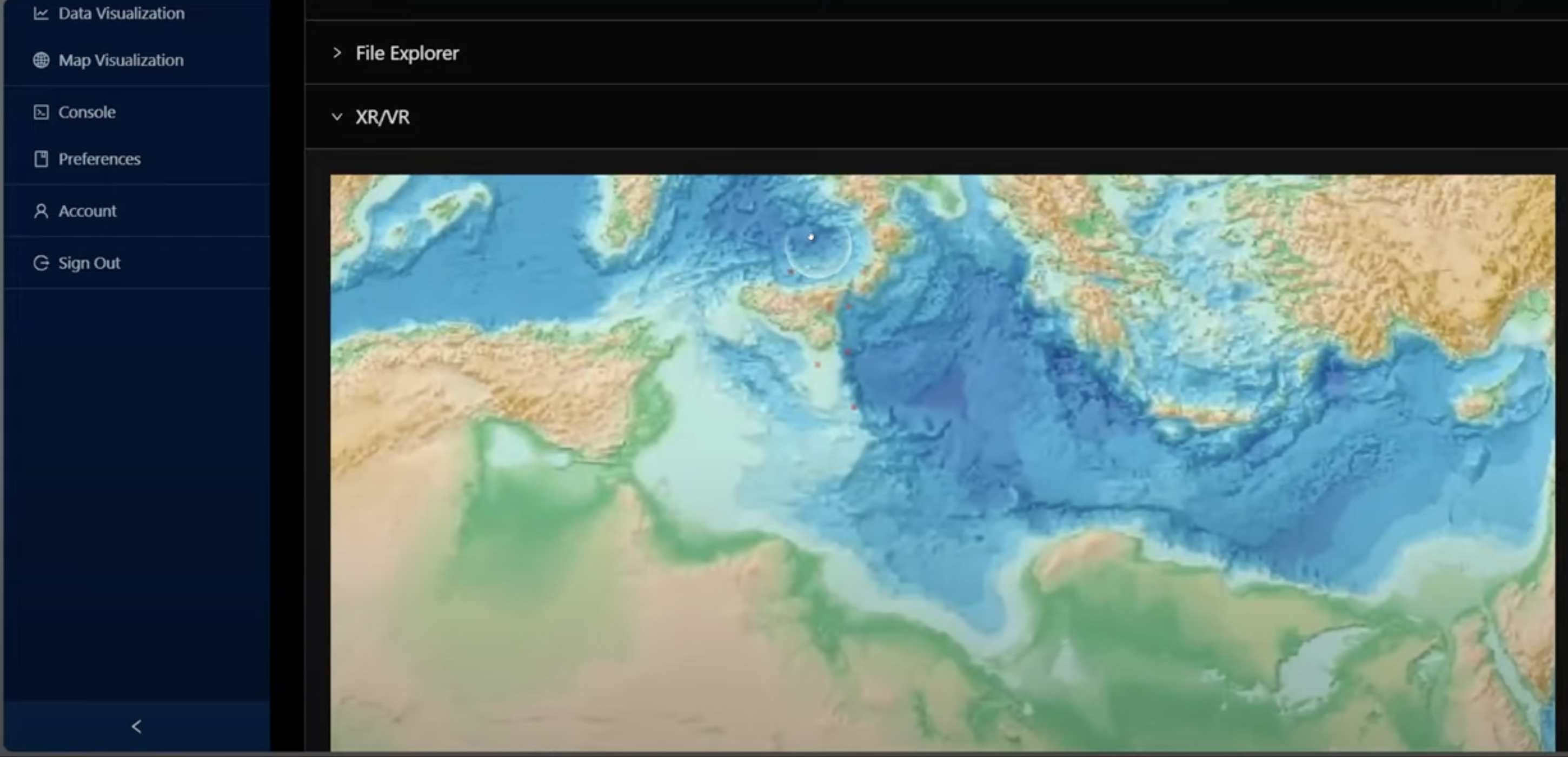
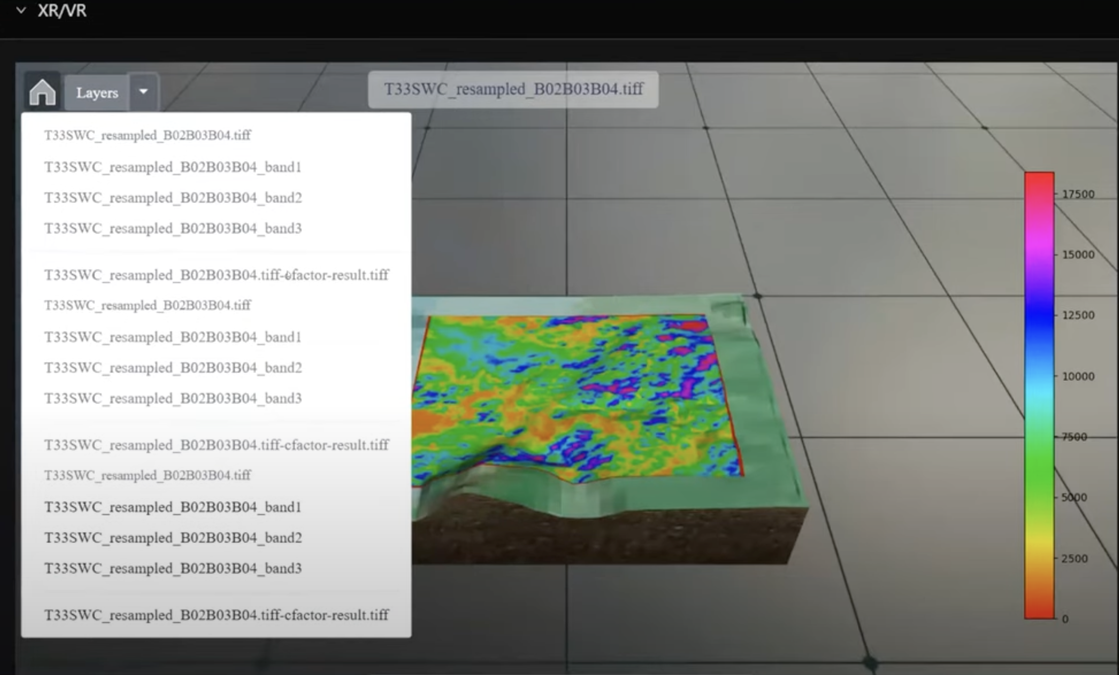
The user can select an area and period of interest in the EO4EU platform to retrieve Sentinel-2 multispectral image bands. Then, the user can draw the workflow to merge the bands and run the trained artificial neural network algorithm, which will yield C-factor values all over the selected area. The user can visualize the result as a color map. Finally, the user can combine the C-factor with other relevant factors of the RUSLE model to obtain an assessment of soil loss by water.
Technical Details
- Overview
-
Soil erosion by water occurs when soil particles are detached, transported, and deposited away due to rainfall, runoff, snow melting, or irrigation. When the soil erosion rate is higher than the soil formation rate, the soil becomes depleted, and the potential of the land to be used productively is reduced. The direct and indirect economic costs of soil erosion are extremely high, as a variety of sectors are negatively impacted. Soil erosion may lead to a decrease in the yield of agricultural areas, physical damage to cultivated fields, and deterioration of water and air quality due to suspended soil particles. As a consequence, reducing soil erosion can provide benefits for several ecosystem services and improve overall socio-economic conditions. For these reasons, soil erosion has raised great attention at the EU level, and soil erosion-related indicators have started to be included in policies to track progress towards sustainability goals. However, such indicators need large-scale, repeatable, high-frequency assessments, which are not easily carried out due to methodological inconsistency and data scarcity.
- Challenge
-
No assessments of soil erosion are carried out periodically at the national (Italian) and EU level, at the
current stage. The available datasets on soil erosion potential have coarse resolution, are not updated, and do not consider sub-annual vegetation dynamics nor allow for scenario-based analysis (e.g., what-if scenarios related to future climate projection or infrastructure development).A preliminary, embryonic-stage service for the evaluation of water-induced soil erosion in Italy is already
available as a Demo Case (dataset and applications) on the Climate Data Store of the Copernicus Climate
Change Service. However, it relies on coarse spatial resolution and generic empirical methods that limit its
regional specificity and predictive capacity.
The proposed UC aims to provide significant enhancements in the robustness and timeliness of soil erosion estimates, using novel, cutting-edge approaches, tools, and data for all the key parameters of the erosion process.
- Solution
-
According to the adopted Revised Universal Soil Loss Equation (RUSLE), the potential soil loss due to
erosion depends on rainfall erosivity and soil susceptibility. The EO4EU platform provides rainfall erosivity
datasets on current and projected precipitation scenarios computed through an empirical model recently
calibrated across Italy. Soil susceptibility to erosion is computed considering three different aspects. First, two different datasets are available on the EO4EU platform regarding the influence of morphological features, such as the terrain slope. The first dataset considers only terrain morphology and was computed by implementing a state-of-the-art workflow, while the second innovatively accounted for the effects of transport infrastructure in interrupting sediment movement. Second, a dataset representing the influence of soil textural and chemical properties is also available, computed by applying consolidated literature empirical models to the most recent gridded soil property datasets. Third, the EO4EU platform offers a cutting-edge algorithm to consider the influence of land cover and plant phenological dynamics in inhibiting or reducing erosion. This algorithm is based on an artificial neural network trained on Earth Observation multispectral images and a state-of-the-art lookup table to assign spatially distributed erosion correction factors depending on dynamic cover properties. A prototype of this algorithm is already implemented in the EO4EU platform, while a more robust version will be deployed soon.
UC5 focuses on five administrative regions in southern Italy, an area experiencing among the highest levels of soil loss by water in Europe and crossed by several transport infrastructures that alter soil dynamics and might be at risk of erosion.
UC5 primarily relies on data from Copernicus services and space components, ensuring maximum consistency and homogeneity. UC5 provides modules for assessing soil loss by water through a repeatable and transparent approach applied to fine spatiotemporal data. These modules, implemented in the EO4EU platform, allow users to explore different precipitation scenarios, account for land cover variability over the year, and evaluate the impact on/of transport infrastructures.
UC5 can support increasing awareness of soil erosion patterns and severity. It can assist decision-makers, like land management actors and territorial planners, in assessing the ecological and socio-economic impact of soil erosion and evaluating mitigation strategies. Also, it can support climate-informed design and management of infrastructures, ensuring a more robust evaluation of hazards and risks posed by water- induced soil erosion.
Input data
Sentinel-2 multispectral images underlie the determination of land cover and management impact on soil erosion. All available 10 and 20 m bands are used to train an artificial neural network algorithm accounting for diverse land cover spectral response in different cover type and phase of the year.
Example: land cover and management (RUSLE C-factor) computation
The user can select an area and period of interest in the EO4EU platform to retrieve Sentinel-2 multispectral image bands. Then, the user can draw the workflow to merge the bands and run the trained artificial neural network algorithm, which will yield C-factor values all over the selected area. The user can visualize the result as a color map. Finally, the user can combine the C-factor with other relevant factors of the RUSLE model to obtain an assessment of soil loss by water.
Impact achieved thanks to the EO4EU Platform
The final service, available on the EO4EU platform, will allow for high-resolution, timely, and periodic estimation of potential soil loss by water-induced erosion. So far, soil loss estimates have been scattered over time and have consisted of coarse-resolution products representing average annual land behavior. In contrast, EO4EU proposes sub-annual products to better identify the timing of potentially adverse rainfall and vegetation patterns.
Also, it adds value to the state-of-the-art computation of morphological impacts on erosion by including the effects of transport infrastructures, thus offering an updated and more realistic estimate of erosion in anthropized areas. Leveraging frequently updated datasets, information will be prompt to users, allowing for fast decision- making and proper territorial management.


“Through the developed service, various end-users can access and process information related to soil erosion by water and the factors that influence this phenomenon. Focusing first on South Italy, the Use Case involves stakeholders interested in land planning and infrastructure design.”